The Value of Action

Lessons from a Decade of Wildfire Investments

EXECUTIVE SUMMARY

KEY POINTS: 30-Second Brief

What We Did

  • Measured a decade: 2015–2024 wildfire modeling comparing Fire-Only vs. Fire+Treatment.
  • Real places, big sample: Five Western counties; ~800K acres treated, >2M acres burned.
  • Focused outcomes: Community safety, infrastructure, water, and fire behavior.

What We Learned

  • Treatments work: Consistent reductions in flame length and exposure across assets.
  • Placement drives returns: Work near people, corridors, and watersheds yields the biggest gains.
  • Scale gap remains: In fire-active counties, burned acres still outpace treated acres.

The Path Forward

  • Scale what works: Expand strategic fuels work and maintain it on a cycle.
  • Plan for beneficial fire: Use treatments to guide fire back to ecological function.
  • Target for ROI + resilience: Prioritize community edges, power corridors, and headwaters.

The Strategic Question

As wildfires grow more frequent and severe, a fundamental question confronts western communities, land managers, and policymakers: Are our investments in fire fuel reduction  treatments actually working?

A firefighter stands in a smoldering forest following a wildfire. Photo: Yasunori Matsui, National Park Service

Each year, wildfires cost the U.S. more than $3 billion to fight1—and far more to recover from. As insurers retreat from high-risk areas, communities absorb the toll: repeated evacuations, destroyed homes, rising health costs, and the quiet erosion of community life that no ledger can capture.

The pressure to act has never been greater—but so are the uncertainties. Fuel treatments are costly—$200 to $1,700 an acre²,³ depending on terrain and method—and they require steady upkeep. Even when hundreds of thousands of acres are treated, it can feel like bailing out the ocean as megafires consume millions.

Firefighters help visitors understand the role of wildfire. Photo: National Park Service

The stakes are high. Invest poorly, and we waste scarce resources while communities remain exposed. Underinvest, and losses escalate. Yet waiting for perfect information carries its own risk: each year of hesitation narrows the window for meaningful action as unplanned fires grow.

So what do we actually know? Do fuel treatments deliver measurable protection? Do the benefits justify the costs? Where do they work best, and why? Most importantly, what lessons from the past decade should guide the next ten years of investment?

These aren’t academic questions—they’re strategic choices that will determine whether we learn to live with fire or remain trapped in a costly cycle of loss and recovery.

As wildfires grow larger and more frequent, communities across the West face a new reality at the edge of fire. Photo: Caleb Cook / Unsplash

PAYING THE PRICE OF DELAY

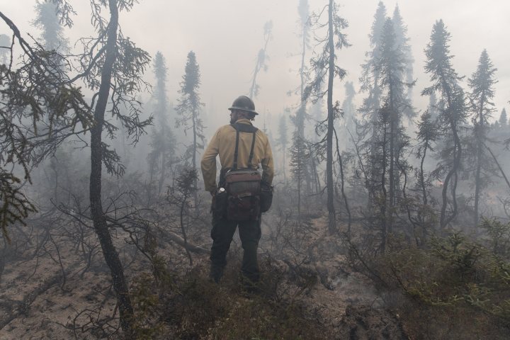
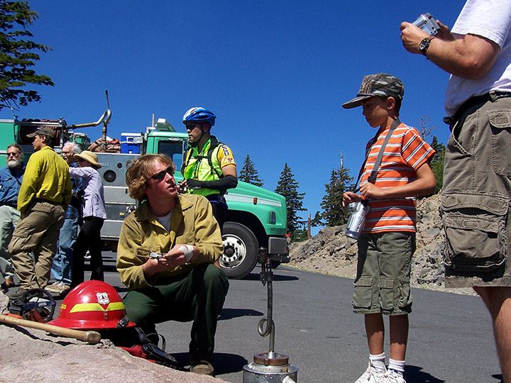
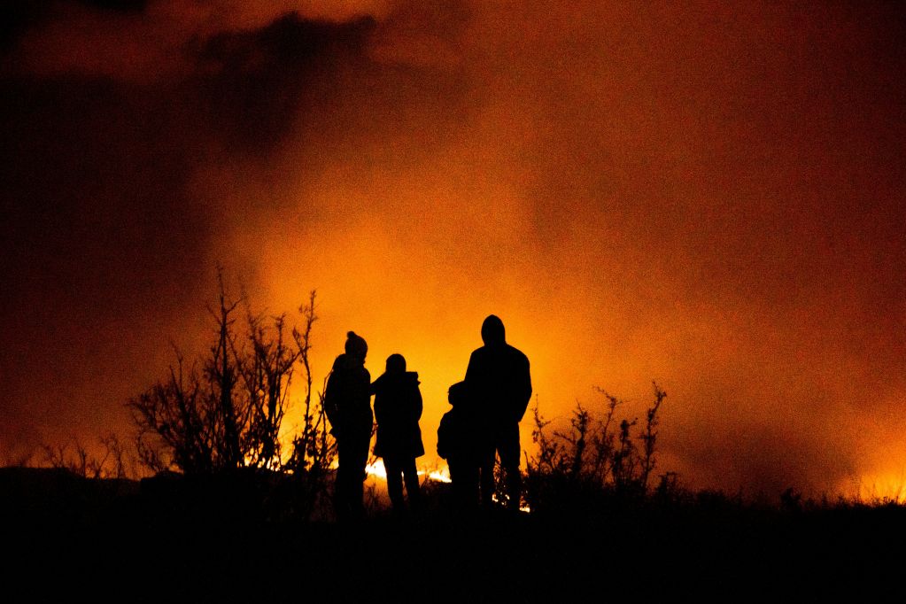
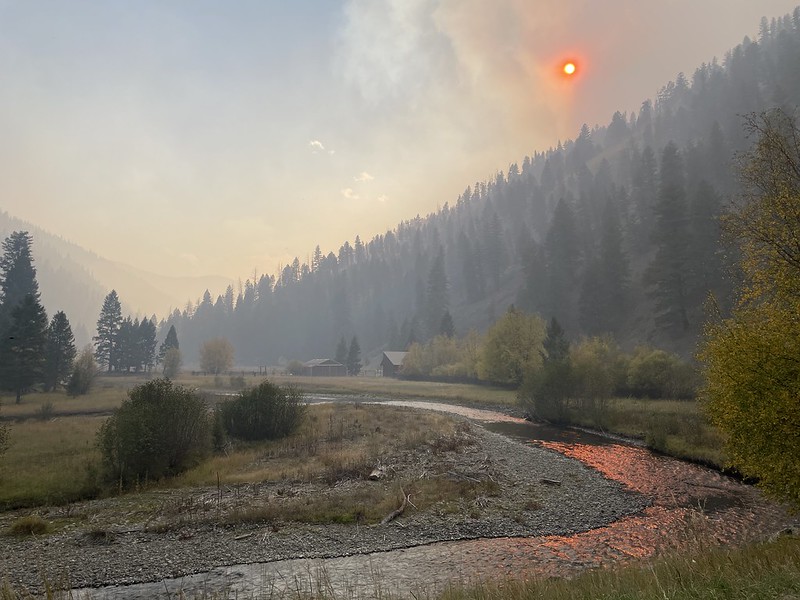
Annual wildfire suppression costs in the U.S. have more than doubled in the past decade, climbing from an average of $2.1 billion per year (2011–2020) to over $3 billion annually in recent years1. But suppression costs tell only part of the story. High-severity fires—burning hotter, larger, and more destructively than the historical norm—now drive total economic impacts estimated at $394–$893 billion each year4, affecting everything from public health to water quality to timber resources. Analyses show that scaling up strategic fuel-reduction treatments could generate net annual economic benefits exceeding $10 billion, with every dollar invested often returning $6–$7 in reduced losses5. Each year of delay in reaching treatment targets adds billions in preventable costs4.

When Investments Meet Reality

Sunlight filters through smoke above an Idaho valley during the Napias Creek Fire in Idaho. Photo: Eric Johnson, U.S. Fish and Wildlife Service / National Interagency Fire Center

Between 2015 and 2024, strategic wildfire investments across the American West underwent a real-world test. Federal agencies, state governments, Tribes, and private landowners implemented fuel treatments across millions of acres, while wildfires burned through many of those same landscapes – creating an unplanned but invaluable experiment in landscape-scale fire management.

This collision of investment and reality comes during what scientists now call the Pyrocene—an era defined by fire. Wildfires are growing larger, burning hotter, and inflicting greater harm than at any point in modern history. 

Our previous analysis, The Cost of Delay, used fire behavior modeling to demonstrate the potential protective value of strategic investment through forward-looking fire behavior modeling. It showed how $138.9 million in targeted treatments could prevent over $1 billion in losses across seven high-risk communities if wildfire struck under modeled scenarios.

This analysis takes a different approach. Rather than modeling optimized treatments for a hypothetical future fire, we examined what a decade of real-world treatments—pursuing goals from community protection to ecosystem restoration—actually accomplished. The question shifted from what investments could do, to what they did:  how much hazard was reduced where treatments were applied?

Using data created by  Pyrologix, a Vibrant Planet company, scientists analyzed this decade of activity through historic wildfire and treatment records, paired with simulations from WildEST and FSim. By comparing wildfire risk in “fire-only” landscapes (shaped by past fires alone) with “fire + treatment” landscapes (shaped by both fires and fuel work), they quantified how the last ten years of treatment reduced baseline hazard across the West.

Fire crews conduct a prescribed burn in Grand Canyon National Park to reduce hazardous fuels and maintain forest resilience. Photo: National Park Service

WildEST (Wildfire Exposure Simulation Tool) models how wildfire behaves and spreads across landscapes6, while
FSim (Fire Simulator for Large Fires) predicts where large fires are most likely to occur7. Together, these models allow scientists to evaluate whether fuel reduction treatments actually reduce wildfire severity when fires occur.

The central question: What value did a decade of strategic action actually create, and what does this evidence teach us about building on documented success?

Five Counties, Five Lessons

To answer this question systematically, we analyzed a decade of treatments and fire activity across eleven western states—from Arizona ponderosa pine to Montana's lodgepole forests to California's mixed conifers. The west-wide analysis reveals a consistent pattern: treatments change how fire behaves, but their effectiveness depends on where and how they're applied.

To see these dynamics on the ground, we focused on five counties with extensive treatments and significant wildfire activity between 2015 and 2024: Coconino (AZ), Flathead (MT), Gunnison (CO), Idaho (ID), and Siskiyou (CA). Together, these landscapes represent the diversity of western ecosystems and management approaches. Together: more than 800,000 acres of fuel treatments and over two million acres during the study period.

What We Analyzed

A park ranger shares information about wildfire management and prescribed burns in Yosemite National Park. Photo: National Park Service

Each County Report Card evaluates four outcome areas:

  • People Protection: How treatments changed risk around homes, hospitals, emergency services, and historic structures.
  • Infrastructure Protection: How treatments changed risk to communication and utility systems—such as transmission lines, power plants, and natural gas infrastructure.
  • Water Protection: Benefits to surface drinking water sources.
  • Fire Behavior Changes: Reductions in modeled flame length, structure risk, and gains in firefighter "workable" acres.

WHAT "FLAME LENGTH" MEANS

Flame length refers to modeled fire behavior—a measure of how intensely fire is expected to burn in treated versus untreated landscapes under similar conditions. Using the WildEST system, scientists calculate expected flame length for every pixel across the landscape, under a range of weather and fuel conditions, weighted by probability. Fuel treatments alter the fuelscape, which in turn changes those modeled flame lengths and the potential severity of future fires. Flame length itself doesn’t capture spotting or ember-driven spread; those processes are represented in other parts of the modeling — including burn probability and value-at-risk components — that inform our broader treatment-effectiveness metrics.

We also report the investment context – treatment costs†, modeled damage reduction‡ (expected structure protection when fire occurs), and the balance between acres treated and acres burned. This isn’t an ROI calculation—we recognize that treatment costs can’t be directly compared to avoided losses as if they were business investments with predictable returns. Instead, these metrics reveal where investments have measurably reduced baseline hazard, and where the scale of fire activity continues to outpace our response.

SEE THE RESULTS

The interactive map below shows how a decade of treatments and wildfires unfolded across five western counties. As you scroll, fires and fuel treatments appear year by year, revealing where mitigation investments and fire activity occurred on the landscape. On the left, Report Cards present the modeled outcomes: where treatments reduced hazard, where they protected people and infrastructure, and how they affected firefighter operational conditions. Together, these views show the relationship between strategic fuel reduction and a decade of fire activity.

Interactive map available on larger screens

This section is optimized for desktop and tablet. On mobile, use the county summaries below.

Scroll to begin ↓
Coconino County, Arizona

A Decade of Investment, Still High Risk

Over the past decade, Coconino invested heavily in wildfire mitigation—treating more than half a million acres to reduce fuels, restore forest structure, and re-establish the role of beneficial fire. Roughly three-quarters of a million acres burned during the same period. This dual reality highlights two key truths about life in fire-adapted forests: first, fire will always be an integral part of these landscapes, and second, the distinction between beneficial and detrimental fires lies in their severity.

What We Learned

Treatments in Coconino worked—and at a meaningful scale. Communities, infrastructure, and watersheds saw clear net benefits, reduced flame lengths, and tens of thousands of acres moved into more workable conditions for firefighters. The takeaway for taxpayers and residents: strategic mitigation delivers value, but to keep pace with the Fire Era, we need sustained, well-placed work around communities and along critical corridors so these gains compound where they matter most.

Treatment Results Summary

Metric Value What It Shows
👥 People 4,445 acres Reduced risk to communities and essential services
🏗️ Infrastructure 2,646 acres Reduced risk to communication and utility infrastructure
💧 Water Resources 23,728 acres Reduced risk to drinking water
🔥 Flame Length -35% (17→11 ft) Lower fire intensity—easier to suppress, safer for responders
🚒 Firefighter Safety +78% More opportunities for crews to safely engage fire
💰 Avoided Damage $36M Estimated structural losses prevented under future fire scenarios
📊 View Detailed Data
Bar chart showing annual acres burned in Coconino, 2015–2024.
Annual acres burned (2015–2024), for quick trend context.

Protected Assets (eNVC Analysis)

  • People:Treatments improved conditions across 4,445 acres, with only 21 acres showing declines (208:1 positive-to-negative ratio)
  • Infrastructure:Treatments improved conditions across 2,646 acres improved with only 30 acres showing declines (87:1 positive-to-negative ratio)
  • Water: Treatments improved conditions across 23,728 acres with only 16 acres showing declines (1,482:1 positive-to-negative ratio)

Fire Behavior Changes

  • Flame Length Reduction:Average flame length dropped from 17 ft to 11 ft—a 6-foot reduction (~35%)
  • Density plot showing shift from higher to Lower flame lengths after treatments in Coconino.
    Distribution shift toward lower flame lengths within treated areas.
  • Structure Risk: Risk to structures dropped across 7,500+ acres of treated landscape, with minimal areas showing decline.
  • Firefighter Safety:Treatments shifted 81,000 acres out of dangerous fire behavior, nearly doubling safe working zones from 104,000 to 185,000 workable acres (+78%)

Investment Context

  • Treatment Investment: $117.4M across 526K acres ($223/acre avg)
  • Modeled Damage Reduction: $35.6M in avoided losses to structures (of which $13.9M protected housing)

Note: Damage reduction values represent modeled future savings if fire occurs, not realized savings from past fires. Excludes suppression, health, and water benefits.

Context: Coconino County spans 12M acres in northern Arizona. Analysis compares 2025 Fire-Only vs Fire+Treatment scenarios using WildEST modeling.

Flathead County, Montana

Gains Across the Board, but Risk Remains

Flathead sits at the edge of Glacier National Park and is no stranger to fire. Over ~40,000 acres of treatments have been applied across forests and communities, and the data show clear protection gains despite large fires in recent years.

What We Learned

In Flathead, decades of investment are helping fire behave as a partner, not a threat. Flame lengths dropped nearly by half in treated areas, protecting people, structures, and forests alike. When treatments are placed near communities and critical systems, they guide fire back into its natural, beneficial role—reducing damage while sustaining forest health. Continued work will help reinforce this positive fire dynamic across the larger landscape.

Treatment Results Summary

Metric Value What It Shows
People 882 acres Reduced risk to communities and essential services
Infrastructure 134 acres Reduced risk to communication and utility infrastructure
Water Resources 49 acres Reduced risk to drinking water
Flame Length -47% (7→4 ft) Lower fire intensity—easier to suppress, safer for responders
Firefighter Safety +37% More opportunities for crews to safely engage fire
Avoided Damage $3.29M Estimated structural losses prevented under future fire scenarios
📊 View Detailed Data
Bar chart showing annual acres burned in Flathead, 2015–2024.
Annual acres burned (2015–2024), for quick trend context.

Protected Assets (eNVC Analysis)

  • People: Treatments improved conditions across 882 acres, with only 3 acres showing declines (305:1 ratio).
  • Infrastructure: Treatments improved conditions across 134 acres, with <1 acre showing declines (301:1 ratio).
  • Water: Treatments improved conditions across 49 acres, with <1 acre showing declines (55:1 ratio).

Fire Behavior Changes

  • Flame Length Reduction: Average flame length dropped from 7 ft to 4 ft (~47%).
  • Density plot showing shift from higher to Lower flame lengths after treatments in Flathead.
    Distribution shift toward lower flame lengths within treated areas.
  • Structure Risk: Risk to structures dropped across 1,000+ acres of treated landscape, with minimal areas showing decline.
  • Firefighter Safety: Treatments shifted 7,455 acres out of dangerous fire behavior, increasing workable acres from 20,358 to 27,812 (+37%).

Investment Context

  • Treatment Investment: ~$10.4M across ~40.1K acres ($259/acre avg).
  • Modeled Damage Reduction (if fire occurs): $3.29M in avoided structural losses (of which $0.56M protected housing).

Note: Damage reduction values represent modeled future savings if fire occurs, not realized savings from past fires. Excludes suppression, health, and water benefits.

Context: Flathead County spans northwestern Montana near Glacier National Park. Analysis compares 2025 Fire-Only vs Fire+Treatment scenarios using WildEST integrated wildfire risk modeling across the full range of weather conditions.

Gunnison County, Colorado

Gunnison: Strong Community Gains, Mixed Infrastructure Results

High in Colorado’s central Rockies, Gunnison’s forests and headwaters define the landscape. Treatments here were relatively modest in footprint (~13,700 acres) but reveal important contrasts across assets: strong protection for people and water, weaker signals for infrastructure.

What We Learned

Gunnison’s treatments delivered the steepest flame-length reductions of any county analyzed—cutting fire intensity by ~80% and nearly tripling workable acres for firefighters. The data show clear protection for people and water, but weaker results for infrastructure, underscoring that placement matters as much as acres treated. Targeting work along power corridors and community edges can translate these strong local results into broader protection.

Treatment Results Summary

Metric Value What It Shows
People 141 acres Reduced risk to communities and essential services
Infrastructure 38 acres Reduced risk to communication and utility infrastructure
Water Resources 590 acres Reduced risk to drinking water
Flame Length -80% (27→5 ft) Lower fire intensity—easier to suppress, safer for responders
Firefighter Safety +195% More opportunities for crews to safely engage fire
Avoided Damage $3.0M Estimated structural losses prevented under future fire scenarios
📊 View Detailed Data
Bar chart showing annual acres burned in Gunnison, 2015–2024.
Annual acres burned (2015–2024), for quick trend context.

Protected Assets (eNVC Analysis)

  • People: Treatments improved conditions across 141 acres, with only 6 acres showing declines (24:1 ratio).
  • Infrastructure: Treatments improved conditions across 38 acres, with <1 acre showing declines (170:1 ratio).
  • Water: Treatments improved conditions across 590 acres, with 7 acres showing declines (80:1 ratio).

Fire Behavior Changes

  • Flame Length Reduction: Average flame length dropped from 27 ft to 5 ft (~80%).
  • Density plot showing shift from higher to Lower flame lengths after treatments in Gunnison.
    Distribution shift toward lower flame lengths within treated areas.
  • Structure Risk: Risk to structures dropped across 300+ acres of treated landscape, with minimal areas showing decline.
  • Firefighter Safety: Treatments shifted 4,706 acres out of dangerous fire behavior, increasing workable acres from 2,418 to 7,124 (+195%).

Investment Context

  • Treatment Investment: ~$2.21M across ~13.7K acres (~$162/acre avg).
  • Modeled Damage Reduction (if fire occurs): ~$3.0M in avoided structural losses (of which ~$2.0M protected housing).

Note: Damage reduction values represent modeled future savings if fire occurs, not realized savings from past fires. Excludes suppression, health, and water benefits.

Context: Gunnison County sits in Colorado’s central Rockies, encompassing high-elevation forests and headwater systems. Analysis compares 2025 Fire-Only vs Fire+Treatment scenarios using WildEST wildfire risk modeling across the full range of weather conditions.

Idaho County, Idaho

Idaho: Forest Gains, But Vast Fires Outpace Work

Idaho County is the largest in the state and one of the most fire-active in the Northern Rockies. Treatments covered ~64,000 acres, yet more than three-quarters of a million acres burned in the study period.

What We Learned

Across Idaho County’s 2.15 million forested acres, treatments improved conditions for people, infrastructure, and water at 20–270:1 benefit ratios, shortened flames by 30%, and added 7,300 new workable acres for firefighters. But with 777,000 acres burning in the same period, these results underscore a scale challenge: treatments are enabling functional fire locally, but remain a fraction of what’s needed to shift the full landscape toward resilience. Expanding the pace and coverage of effective work is the clearest path toward durable coexistence with fire.

Treatment Results Summary

Metric Value What It Shows
People 416 acres Reduced risk to communities and essential services
Infrastructure 121 acres Reduced risk to communication and utility infrastructure
Water Resources 2,319 acres Reduced risk to drinking water
Flame Length -30% (14→10 ft) Lower fire intensity—easier to suppress, safer for responders
Firefighter Safety +32% More opportunities for crews to safely engage fire
Avoided Damage $9.3M Estimated structural losses prevented under future fire scenarios
📊 View Detailed Data
Bar chart showing annual acres burned in Idaho, 2015–2024.
Annual acres burned (2015–2024), for quick trend context.

Protected Assets (eNVC Analysis)

  • People: Treatments improved conditions across 416 acres, with 19 acres showing declines (21:1 ratio).
  • Infrastructure: Treatments improved conditions across 121 acres, with <1 acre showing declines (272:1 ratio).
  • Water: Treatments improved conditions across 2,319 acres, with 95 acres showing declines (24:1 ratio).

Fire Behavior Changes

  • Flame Length Reduction: Average flame length dropped from 14 ft to 10 ft (~30%).
  • Density plot showing shift from higher to Lower flame lengths after treatments in Idaho.
    Distribution shift toward lower flame lengths within treated areas.
  • Structure Risk: Risk to structures dropped across 675+ acres of treated landscape, with minimal areas showing decline.
  • Firefighter Safety: Treatments shifted 7,297 acres out of dangerous fire behavior, increasing workable acres from 22,528 to 29,825 (+32%).

Investment Context

  • Treatment Investment: ~$15.5M across ~64.1K acres (~$243/acre avg).
  • Modeled Damage Reduction (if fire occurs): ~$9.3M in avoided structural losses (of which ~$3.1M protected housing).

Note: Damage reduction values represent modeled future savings if fire occurs, not realized savings from past fires. Excludes suppression, health, and water benefits.

Context: Idaho County covers over 8,500 square miles of central Idaho wilderness and rural communities.

Siskiyou County, California

Siskiyou: Big Forest Gains, Community Risk Persists

Siskiyou sits at the crossroads of California and Oregon fire corridors. With one of the largest treated acreages of any county analyzed, Siskiyou’s investments reflect both local risk and its importance for regional fire resilience.

What We Learned

Siskiyou’s extensive treatment network—covering more than 147,000 acres—reduced flame lengths by ~35%, improved firefighter safety across ~11,000 acres, and delivered 20–26:1 protection ratios for people, infrastructure, and water. Even amid the region’s large wildfires, treated forests burned more moderately, suggesting fire is beginning to function more naturally again. The goal isn’t to stop fire, but to steward it—using treatments to guide it back into its ecological role while protecting the people and places that depend on these forests. The lesson is clear: treatments matter, but scaling them to keep pace with fire is the defining challenge.

Treatment Results Summary

Metric Value What It Shows
People 1,570 acres Reduced risk to communities and essential services
Infrastructure 618 acres Reduced risk to communication and utility infrastructure
Water Resources 5,106 acres Reduced risk to drinking water
Flame Length -35% (6→4 ft) Lower fire intensity—easier to suppress, safer for responders
Firefighter Safety +17% More opportunities for crews to safely engage fire
Avoided Damage $3.9M Estimated structural losses prevented under future fire scenarios
📊 View Detailed Data
Bar chart showing annual acres burned in Siskiyou, 2015–2024.
Annual acres burned (2015–2024), for quick trend context.

Protected Assets (eNVC Analysis)

  • People: Treatments improved conditions across 1,570 acres, with 62 acres showing declines (25:1 ratio).
  • Infrastructure: Treatments improved conditions across 618 acres, with 23 acres showing declines (26:1 ratio).
  • Water: Treatments improved conditions across 5,106 acres, with 231 acres showing declines (22:1 ratio).

Fire Behavior Changes

  • Flame Length Reduction: Average flame length dropped from 6 ft to 4 ft (~35%).
  • Density plot showing shift from higher to Lower flame lengths after treatments in Siskiyou.
    Distribution shift toward lower flame lengths within treated areas.
  • Structure Risk: Risk to structures dropped across 1,970+ acres of treated landscape, with minimal areas showing decline.
  • Firefighter Safety: Treatments shifted 11,467 acres out of dangerous fire behavior, increasing workable acres from 68,253 to 79,720 (+17%).

Investment Context

  • Treatment Investment: ~$55.1M across ~147.5K acres (~$373/acre avg).
  • Modeled Damage Reduction (if fire occurs): ~$3.9M in avoided structural losses (of which ~$1.5M protected housing).

Note: Damage reduction values represent modeled future savings if fire occurs, not realized savings from past fires. Excludes suppression, health, and water benefits.

Context: Siskiyou County lies in northern California’s Klamath region, encompassing both rural communities and vast National Forest lands.

Five Counties, One Pattern

Each county tells the same core story in its own way: strategic, well-placed treatments consistently reduced flame length and structural exposure. Yet the degree and character of that success vary with terrain, fuels, and design. Understanding those differences—how and why outcomes diverge—is the key to scaling resilience across landscapes.

Fires & Treatments Through

2015

County
Wildfires
Treatments

Patterns Across Landscapes

Across five counties—from Coconino's ponderosa pine forests to Siskiyou's mixed conifers—the evidence reveals a consistent pattern with important nuances. Treatments changed how fire behaved on the landscape. Where fuels were strategically reduced, flames stayed lower, risk to structures dropped, and firefighters gained safer operational zones. Communities saw measurable protection, infrastructure vulnerabilities decreased, and watersheds showed net benefits.

A prescribed burn in Grand Teton National Park helps restore natural fire cycles and protect nearby forests and communities. Photo: National Park Service

But the data also teaches us about placement and context. Some counties delivered strong returns across all objectives—people, infrastructure, and water. Others showed mixed results: excellent community protection but weaker watershed benefits, or vice versa. These variations aren't failures—they're signals about how terrain, fuel types, treatment intensity, placement, and local conditions shape outcomes. They remind us that where we invest matters as much as how much we invest.

What stands out most clearly is this: treatments aren't about stopping fire. Fire will always move through these forests—it's part of how they function. Treatments change fire's character or behavior. They convert high-severity crown fires that sterilize soil and destroy watersheds into low-intensity surface fires that recycle nutrients, clear undergrowth, and maintain forest resilience.

The scale challenge, however, remains stark. Even in the most active landscapes, wildfire still reaches far more acres than management does. Yet where fire and treatments meet, the results are consistently positive—shorter flames, fewer structures lost, and larger areas where firefighters can work safely. This pattern holds across forest types, treatment strategies, and fire conditions, underscoring a core truth:

when investments are made strategically and at scale, treatments don’t compete with fire—they prepare the landscape to live with it.

Fire crews conduct a prescribed burn in Sequoia and Kings Canyon National Parks to reduce hazardous fuels and maintain fire-adapted forest conditions. Photo: National Park Service

The question ahead isn't whether strategic treatments work—the fire model outputs from these five counties demonstrates they do. The question is how to deploy them more strategically: deploying effective treatments where risk is highest, sustaining maintenance over time, and scaling investment to match the current reality of our modern Fire Era. Success looks different in every landscape, but the core principles translate: strategic placement, appropriate design, and long-term commitment deliver measurable value.

The path forward is one of continuity, not conflict. Restoring resilience — for people, water, forests, and infrastructure — means expanding the footprint of managed fire, not eliminating it. When fuel treatments and prescribed burns are planned strategically—around communities, along transportation and power corridors, and across key ecological zones—they lay the groundwork for fires that behave within their natural range of variability, allowing for wildfire defense of key assets and resources when needed. This is how landscapes heal: by combining human intention with fire’s ecological role. The outcome is a future where fires burn more safely, forests endure longer, and people can coexist with the process that has shaped these ecosystems for millennia.

A park ranger explains the role of prescribed fire in maintaining healthy forest ecosystems. Photo: National Park Service

"Treatments can reduce wildfire severity, which is key to protecting important forest habitats...This gives us hope that by accelerating the use of these tools, in conjunction with work to promote fire adapted communities, we can address the wildfire crisis together" 8,9

Scaling What Works

The findings present a strong argument that strategic wildfire investments do deliver measurable protection. The pattern holds across different forest types, treatment approaches, and fire weather conditions.

The Cost of Delay story showed us what was at stake through forward-looking modeling—the mounting costs of inaction and the potential value of strategic investment. The Value of Action demonstrates what a decade of real-world implementation actually achieves when treatments meet fire on the ground. Our analysis of these treatments confirms what forest managers have long understood: well-placed, well-designed treatments change fire behavior in ways that protect what we value.

Still, the analysis also surfaces the challenge ahead. Success is uneven. Effectiveness varies by county, asset type, and—most importantly—how well treatments intersect with areas of highest fire probability. Some investments delivered outsized protection and avoided losses that exceeded their costs many times over. Others, often constrained by geography, timing, or intensity, showed modest returns.

The clearest lesson: scaling up isn’t just about doing more—it’s about doing more of what works, where it matters most.

Firefighters cool down hot spots following a prescribed burn at Baskett Slough National Wildlife Refuge in Oregon. Photo: Seth Ontiveros, U.S. Fish and Wildlife Service

The question now shifts from whether strategic treatments deliver value to how we systematically deploy them at the pace and scale the Fire Era demands. What would it take to replicate the successes we've documented while learning from the mixed outcomes? How do different investment levels—informed by what worked and what didn't—shape future outcomes for community safety, economic resilience, water security, and forest health?

Low-intensity fire in Coconino National Forest reduces fuels while preserving mature trees — showing how well-placed treatments help forests live with fire. Photo: U.S. Forest Service / Wikimedia Commons

The next step will deepen this understanding by moving from modeled wildfire potential to observed outcomes—empirically evaluating how treatment footprints have interacted with real wildfires on the ground. This expanded analysis will also broaden the scope of what we measure, linking management actions not only to changes in fire behavior, but to impacts that touch people’s daily lives and regional economies—air quality (PM₂.₅), recreation, tourism, the stability of live trees, and the role of treatments in control lines for wildfire. Together, these metrics will offer a broader picture of how strategic investment shapes the health, safety, and prosperity of fire-adapted communities through tangible outcome metrics.

The opportunity is becoming clearer —we are getting better at knowing what works. The challenge is applying those lessons deliberately, persistently, and at a scale that matches the reality we're living in.

methods

HOW TREATMENT RESULTS WERE DETERMINED

Our calculations leveraged Vibrant Planet’s risk reduction analysis methodologies, which combine fire behavior modeling, geospatial overlays, and resource and asset response functions to planned and unplanned disturbances to estimate potential effects from historical planned treatments. We summarize our data sources and steps below, with additional details available in the U.S. Forest Service’s General Technical Report RMS-GTR-31510.

  • Step 1 – Data sources: In this step, we describe the sources of our data inputs. We describe our use of data from these sources in later steps.
    • County Data
      • The U.S. Census Bureau Topologically Integrated Geographic Encoding and Referencing (TIGER) System11 provides data for use with geographic information systems (GIS) software, including a variety of national and state-based geodatabases for geographic boundaries and features.
    • Treatment data
      • The ReSHAPE12 program provides data collected and facilitated by the Southwest Ecological Restoration Institute (SWERI) for assessing, planning, and monitoring fuel treatment interactions with wildfires across boundaries. SWERI analyses and reports on fuel treatment effects.
    • Wildfire perimeter data
      • Welty and Jeffries13 published a processed fire perimeter atlas for the United States that covers the 1835 to 2020 time period
      • NIFC’s WFIGS Interagency Fire Perimeters14 is a lightly processed fire perimeter atlas for the United States that completely covers the 2021 to 2024 time period, with additional historic fires being added as they go through the light processing steps. 
  • Fuelscape data
    • Landscape Fire and Resource Management Planning Tools (LANDFIRE)13 is a shared interagency wildland fire management data program managed by the U.S. Department of Agriculture (USDA) Forest Service (USFS) - Fire and Aviation Management and the U.S. Department of the Interior (DOI) – Office of Wildland Fire. LANDFIRE provides landscape-scale geospatial products of biological and ecological data that support all-lands planning, fire and natural resources management, operations, analyses and assessments.
    • The National Fire Plan Operations and Reporting System (NFPORS)14 is an inter-departmental, inter-agency data management and reporting system developed, operated, and maintained by the DOI collaboratively with the USDA. NFPORS is the DOI authoritative system of record for accomplishments in fuels, restoration & rehabilitation, and community assistance. NFPORS supports reporting at field, regional, and national levels.
    • The Forest Activity Tracking System (FACTS)15 is the USFS agency standard for managing information about activities related to fire/fuels, silviculture, and invasive species. FACTS is an activity tracking application for all levels of the Forest Service.
    • The CAL FIRE Management Activity Project Planning and Event Reporter (CalMAPPER)16 is a CAL FIRE internal GIS application for capturing forest and fuels management projects and associated activities across programs within CAL FIRE.
  • Highly Valued Resources and Assets (HVRA) & county context data
    • The Wildfire Risk to Communities (WRC) website17 offers interactive maps, charts, and resources to help communities understand, explore, and reduce wildfire risk. It was created by the USDA Forest Service under the direction of Congress and is designed to help community leaders, such as elected officials, community planners, and fire managers. It includes population and building datasets, such as those used in this analysis18.
    • Pyrologix completed a National Wildfire Risk Assessment (NWRA) for the USFS in 2024 and again in 2025. HVRA rasters generated for people, infrastructure, and water HVRAs during those efforts were used in this analysis. For further information on risk assessment data and supplementary information please visit the Pyrologix website.
  • Step 2 – Selecting counties as analysis areas: We identified the five selected counties as having substantial treatment and fire activity over the past decade.
    • Total treatment acres were calculated for all counties in the west using the ReSHAPE database12.
    • Total acres burned were calculated from the wildfire perimeter data noted above.
    • Counties were ranked according to both measures, and five counties were selected from top ranking counties to reflect diverse geographic contexts and forest types across the West, providing insight on how results varied across diverse environments.
  • Step 3 – Fire modeling: We modeled wildfire hazard for the five counties,  providing understanding of wildfire risk across the counties by  illustrating how likely fires are to happen (i.e. probability), how intense they could get, and how important resources would respond to changes in  fire hazard.
    • Fuelscapes
      • Fuelscapes are required for FSim and WildEST fire modeling, and are the foundation of any wildfire hazard assessment. Fuelscapes reflect recent disturbances (planned or unplanned) and are calibrated to represent the potential fire behavior observed in recent historical wildfire events.
      • A fuelscape is the spatial representation of fuels, vegetation, and land features that influence fire behavior. LANDFIRE provided initial datasets, which we modified based on calibration workshops involving local wildfire and resource specialists. While the LANDFIRE yearly disturbance data provides a reasonable overview of these changes, these were supplemented with treatment-specific sources such as FACTS, NFPORS, and CalMAPPER. The treatment-specific attributes associated with these datasets enable more accurate attribution and analysis of the effectiveness of historical treatments.
      • We developed two fuelscapes for this analysis to evaluate the effectiveness of real historical treatments (i.e. intentional disturbance) from the past 10 years on reducing wildfire hazard.  By evaluating differences between fire modeling metrics based on the two different fuelscapes, we could assess treatment effects.
        • Fire-Only: reflects hypothetical conditions in 2025 by including only unintentional historical disturbance, or wildfire, between 2015 and 2024 (inclusive).
        • Treatment + Fire: reflects current conditions in 2025 by including all historical fuel disturbances (intentional/treatments and unintentional/wildfires) between 2015 and 2024 (inclusive).
    • HVRAs
      • Assessing risk reduction to HVRAS due to treatment effects first requires the Identification, mapping, and assessment of resources and assets of interest. This analysis specifically addressed people, water, and infrastructure HVRAs.
        • People: Housing units, hospitals, emergency services, and historic structures were identified using the 30m “People” HVRA raster generated by Pyrologix for NWRA. Sources were mapped and valued using data aggregated by Pyrologix, including Housing Unit Density from the WRC effort and other essential service locations.
        • Surface drinking water: Surface drinking water source areas were identified using the 30m “Water” HVRA raster generated by Pyrologix for NWRA. Sources were mapped and valued using data maintained by the EPA that included source water protection areas and associated population served.
        • Infrastructure (transmission + gas lines): Critical Infrastructure were identified using the 30m “Infrastructure” HVRA raster generated by Pyrologix for NWRA. Infrastructure locations were mapped using HIFLD spatial data.
    • FSim burn probability
      • For this analysis, we modeled wildfire probability for the western US using the large-fire simulator FSim7. This simulator runs thousands of scenarios to estimate when and where big fires might start, spread, and progress along with how effective suppression might be. It uses detailed local information like fuels, vegetation, weather, terrain, and past fire records. For more information about FSim, see the FSim Best Practices Guide.
    • WildEST
      • To estimate additional fire metrics such as wildfire intensity, we used a utility called WildEST23. WildEST is a deterministic wildfire modeling tool that integrates spatially continuous weather input variables, weighted based on how they will likely be realized on the landscape. For each of the two fuelscapes above, we first simulated a burn probability dataset in FSim. Then each fuelscape and its corresponding burn probability served as inputs to WildEST, along with HVRAs, to simulate various fire datasets including flame front characteristics (e.g. flame lengths), risk to structures (e.g. Damage Potential), and other risk datasets (e.g. risk to other resources and assets). These WildEST outputs were used directly in the analyses described below. For more information about WildEST, see the WildEST documentation.
  • Step 4 - Initial Analysis Steps: All metrics included in the county report cards were initially processed as described in this step.
    • All data was processed in the NAD83 Albers (WKID 5070) geospatial coordinate system
    • County boundaries defined the processing extent and mask for all analyses.
      • Vector datasets (points, lines, and polygons) were clipped to each county boundary.
      • Raster datasets were clipped using Extract By Mask, with grid alignment (cell size, origin, and snapping) taken from the reference wildfire-modeling rasters to ensure consistency across fuelscape scenarios.
  • Step 5 - Context metrics: We included these metrics for each county report card to provide context.
    • Below we provide the definition and methodology specifics for each context metric:
      • Treated acres: The sum of acres intentionally treated between 2015 and 2024 within the county boundary. Treatment polygons were taken from ReSHAPE, and we included both planned mechanical treatments and planned ignition treatments. We excluded unplanned ignitions (wildfires) from treatments. We only retained polygons showing ≥10% modeled change to ensure treatments analyzed appropriately reflected work on the ground and in the fire modeling outputs. These filtered treatments were dissolved to create unique footprints by county and to avoid double-counting acres from overlapping treatments.
      • Burned acres: The sum of acres burned by an unplanned wildfire event between 2015 and 2024 within the county boundary. Wildfire acres were not included if they occurred prior to treatment in that area.
      • People: The total population within the county. Using the WRC population count raster, we summed pixel values within the county raster mask.
      • Structures: The total number of structures (both housing units and other buildings) within the county. Using the WRC building count raster, we summed pixel values within the county raster mask.
      • Forested: The total acres of forested land within the county. Using the vegetation cover raster from our fuelscapes, we derived the acreage from the number of forested pixels within the county raster mask by only counting pixels with tree cover.
      • Surface drinking water: The total acres of surface drinking water protection areas. Using the surface drinking water HVRA raster, we derived the acreage from the number of protection area pixels within the county raster mask.
      • Transmission + Gas lines: The total miles of transmission and gas lines. Using the infrastructure HVRA raster, we derived the miles of utility lines within the county raster mask.
  • Step 6 - Treatment effects: For each county report card, we evaluated the effects treatment had on the following metrics.
    • We quantified treatment effects by comparing modeled wildfire behavior and impacts between Fire-Only and Treatment+Fire fuelscape scenarios (2015-2024). While calculations were performed at both county and treatment scales for validation, all reported metrics represent changes within treatment footprints only.
      • Protected assets (eNVC analysis): The difference in Expected Net Value Change (𝚫eNVC) was used to measure how treatments changed wildfire risk to Highly Valued Resources and Assets (HVRAs)—people, infrastructure, and water. WildEST calculated eNVC for each HVRA according to the methodology in GTR-31510. We adjusted the sign of each WildEST eNVC raster so positive values reflected a positive outcome. Then 𝚫eNVC was derived by subtracting the WildEST eNVC raster for Fire-Only from the Treatment+Fire eNVC raster.
        • Positive 𝚫eNVC indicates a benefit or value gain due to treatment. Negative 𝚫eNVC values indicates areas with potential loss, which could reflect the regrowth of fuels after treatment. Together, these show how treatments shifted acres from loss to benefit categories.
          • People: 𝚫eNVC values quantified both benefits and losses around homes, hospitals, emergency services, and historic structures.
          • Infrastructure: 𝚫eNVC values quantified both benefits and losses for critical infrastructure for communication and utility systems.
          • Water: 𝚫eNVC values quantified both benefits and losses to surface drinking water sources.
      • Fire behavior changes: Changes in wildfire behavior were derived from WildEST outputs for both fuelscapes:
        • Flame Length Reduction:  Changes in mean flame length within treated areas. We calculated this by comparing WildEST mean flame lengths from Fire-Only to Treatment+Fire scenarios.
        • Structure Risk Reduction: Changes in building exposure to wildfire within treated areas. We calculated this by comparing WildEST building exposure from Fire-Only to Treatment+Fire scenarios.
        • Firefighter Safety: Changes in total area where flame lengths are likely to be less than four feet, which allows workable conditions for direct suppression rather than requiring indirect tactics. We calculated this by comparing the four-foot WildEST Flame Length Exceedance Probability (FLEP) from Fire-Only to Treatment+Fire scenarios.
      • Investment Context
        • Investment metrics provide context for the scale of public and private effort behind the wildfire treatments analyzed here. These figures are not an economic return calculation or benefit–cost analysis; rather, they show how much work was done, where, and what measurable hazard reduction those investments achieved. The goal is transparency—linking tangible spending on treatments to modeled outcomes that demonstrate their functional value on the ground.
          • Treatment Investment: Treatment investments were compiled from the ReSHAPE database and filtered as described above for context metrics. To estimate reported spending, total treatment costs were summed from contributing treatments to the dissolved county footprint. We then divided the summed cost by the total treated acreage to calculate average per-acre costs. While actual treatment costs vary widely by terrain, method, and local conditions, the resulting range in this dataset—roughly $200 to $1,700 per acre—is consistent with known regional averages from state and federal reporting. These values represent reported costs, not full expenditures, and likely undercount personnel, administrative, and monitoring costs that are not systematically tracked across agencies.
          • Modeled Damage Reduction (if a fire occurs): Modeled Damage Reduction (MDR) represents the conditional, modeled reduction in structure damage expected if a fire were to occur under current (Treatment+Fire) conditions compared to a counterfactual (Fire-Only) scenario. MDR was calculated only for structures within treatment footprints by computing the reduction in WildEST Damage Potential between scenarios (ΔDP = max[0, DP_FireOnly − DP_Tx+Fire]) and multiplying by standardized structure replacement values ($600,000 per building, $504,000 per housing unit). These values represent typical replacement costs based on average structure sizes (2000 sq ft for buildings at $300/sq ft, 1800 sq ft for housing at $280/sq ft)25–28. These modeled reductions are not realized savings, and they do not include secondary or indirect benefits such as avoided suppression costs, improved air quality, or watershed protection. Instead, MDR offers a transparent, consistent metric for quantifying how treatments have changed the modeled risk environment for built infrastructure.
        • How to interpret these metrics: Together, treatment investment and modeled damage reduction provide a scale comparison, not a financial return. They show where significant spending has coincided with measurable hazard reduction, highlighting both the effectiveness and the remaining gap between the scale of our management efforts and the scale of the wildfire challenge. These values help contextualize progress—not profit—by demonstrating that where we've invested strategically, measurable reductions in risk now exist on the ground.

Methodology adapted from Vibrant Planet’s planning workflows and ROI modeling practices. To learn more connect with us.

Treatment costs from ReSHAPE/TWIG database; likely underreported as not all expenditures are consistently tracked in agency systems.

‡ Conditional, modeled reduction in future building damage within treatment footprints; not realized savings or annualized; excludes suppression, health, water, and other benefits. See Methods for details.

Citations:
  1.  National Interagency Fire Center, Suppression Costs (2024). https://www.nifc.gov/fire-information/statistics/suppression-costs.
  2. D. Saha, A. Rudee, H. Leslie-Bole, T. Cyrs, The economic benefits of the new climate economy in rural America. WRIPUB, doi: 10.46830/wriwp.20.00149 (2021).
  3. A. Call, N. Tomczyk, K. A. Withnall, P. R. Dappen, D. Heusinkveld, S. Mueller, B. Holloway, K. Shennan, J. Herring, A. Franko, M. M. Colavito, A. D. Kimple, A. S. Meador, C. S. Stevens-Rumann, A new geodatabase of fuel treatments across federal lands in the USA. Sci Data 12, 1485 (2025).
  4. C. Crowley, A. Miller, R. Richardson, J. Malcom, “Increasing damages from wildfires warrant investment in wildland fire management” (R-2003-001, U.S. Department of the Interior, 2003).
  5. P. Brown, “Cost-Effectiveness Of Large-Scale Fuel Reduction for Wildfire Mitigation in California” (The Breakthrough Institute, 2024); https://thebreakthrough.org/issues/energy/cost-effectiveness-of-large-scale-fuel-reduction-for-wildfire-mitigation-in-california.
  6. J. H. Scott, C. J. Moran, M. N. Callahan, A. M. Brough, M. P. Thompson, “Methods and outputs of the Wildfire Exposure Simulation Tool (WildEST)” (Pyrologix, 2024); https://osf.io/eyfrt.
  7. M. A. Finney, C. W. McHugh, I. C. Grenfell, K. L. Riley, K. C. Short, A simulation of probabilistic wildfire risk components for the continental United States. Stochastic Environmental Research and Risk Assessment 25, 973–1000 (2011).
  8. U.S. Department of Agriculture, Forest Service, Science review shows fuel treatments reduce future wildfire severity. https://phys.org/news/2024-06-science-fuel-treatments-future-wildfire.html
  9. K. T. Davis, J. Peeler, J. Fargione, R. D. Haugo, K. L. Metlen, M. D. Robles, T. Woolley, Tamm review: A meta-analysis of thinning, prescribed fire, and wildfire effects on subsequent wildfire severity in conifer dominated forests of the Western US. Forest Ecology and Management 561, 121885 (2024).
  10. J. H. Scott, M. P. Thompson, D. E. Calkin, “A wildfire risk assessment framework for land and resource management” (RMRS-GTR-315, U.S. Department of Agriculture, Forest Service, Rocky Mountain Research Station, Ft. Collins, CO, 2013); https://doi.org/10.2737/RMRS-GTR-315.
  11. U.S. Census Bureau, TIGER/Line Geodatabases, (2020); https://www.census.gov/geographies/mapping-files/time-series/geo/tiger-geodatabase-file.2020.html. 
  12. Southwest Ecological Restoration Institute, ReSHAPE, https://reshapewildfire.org/twig/layers (2025); https://reshapewildfire.org/home.
  13. J. Welty, M. Jeffries, Combined wildland fire datasets for the United States and certain territories, 1800s-Present, U.S. Geological Survey (2021); https://doi.org/10.5066/P9ZXGFY3. 
  14. National Interagency Fire Center, WFIGS Interagency Fire Perimeters, (2025); https://nifc.maps.arcgis.com/home/item.html?id=5e72b1699bf74eefb3f3aff6f4ba5511#overview.
  15. U.S. Department of the Interior, Geologic Survey, U.S. Department of Agriculture, LANDFIRE: Landscape Fire and Resource Management Planning Tools, (2024); https://landfire.gov/
  16. U.S. Department of the Interior, NFPORS | Wildland Fire Application Information Portal (2025). http://www.wildfire.gov/application/nfpors.
  17. U.S. Department of Agriculture, Forest Service, Forest Service Activity and Tracking System (FACTS), FSGeodata Clearinghouse (2024); https://data.fs.usda.gov/geodata/edw/datasets.php
  18. CAL FIRE, CalMAPPER Forest and Fuels Management Projects, (2020); https://www.arcgis.com/home/item.html?id=4a73accda8314ccd9442d365bf32f51d. 
  19. U.S. Department of Agriculture, Forest Service, Wildfire Risk to Communities | Download (2024). https://wildfirerisk.org/download/.
  20. J. H. Scott, G. K. Dillon, M. Jaffe, M. N. Callahan, E. C. Karau, M. T. Lazars, Wildfire Risk to Communities: Spatial datasets of wildfire risk for populated areas in the United States, version 2nd Edition (2024); https://doi.org/10.2737/RDS-2020-0060-2.
  21. J. H. Scott, A deterministic method for generating flame-length probabilities. In: Hood, Sharon M.; Drury, Stacy; Steelman, Toddi; Steffens, Ron, [eds.]. Proceedings of the Fire Continuum-Preparing for the future of wildland fire; 2018 May 21-24; Missoula, MT. Proceedings RMRS-P-78. Fort Collins, CO: U.S. Department of Agriculture, Forest Service, Rocky Mountain Research Station. p. 195-205. 78, 195–205 (2020). 
  22. U.S. Army Corps of Engineers, National Structure Inventory, (2025); https://www.hec.usace.army.mil/confluence/nsi.
  23. Home-Cost, Cost Per SF by State, Home-Cost | Accurate Cost-to-Build a House Calculator (2024). https://www.home-cost.com/cost-per-sf-by-state/.
  24. B. Behere, How Much Does It Cost to Build a House in 2025?, Houzeo Blog (2025). https://www.houzeo.com/blog/how-much-does-it-cost-to-build-a-house/.
  25. U.S. Census Bureau, CHARS - Highlights (2024). https://www.census.gov/construction/chars/highlights.html.